Real-time public notification of sewer overflows
We are proud to represent the first municipality in Ontario to help its residents make more informed decisions on recreational water use, as we continue to both reduce sewer overflows and openly share information. Water users can consider our real-time sewer overflow map before they swim at certain locations at Lake Ontario within 48 hours of a heavy rainfall.
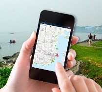
Kingston’s waterfront is a clean, safe place to swim, fish or boat. But, bacteria levels in lakes and rivers are higher up to 48 hours after a heavy rainfall and swimming is not recommended during that time. Sewer overflows can contribute to the problem. Utilities Kingston staff has improved its monitoring equipment and now offers an online map that shows where sewer overflows have occurred in real time.
When Kingstonians or visitors plan to swim, fish or boat in Lake Ontario within 48 hours after heavy rain, they are encouraged to first check the map at www.UtilitiesKingston.com/Overflows.
Sewer overflow locations affecting the Great Cataraqui River, the Little Cataraqui Creek, and other surrounding bodies of water are also shown.
Utilities Kingston and the City of Kingston continue to improve infrastructure to reduce sewer overflows. Over the last twenty years, they have been working to separate Kingston’s historic combined sewer system and install large holding tanks to reduce overflows and rainwater that enters the sanitary system. These activities help reduce the sewer overflows associated with heavy rainfalls.
Additional resources available at www.UtilitiesKingston.com/Overflows include:
- A brief video animation about sewer overflows in Kingston
- A real-time sewer overflow map
- An overview of projects to reduce sewer overflows
- Frequently asked health and technical questions